Photos of Hung Yen province
Pho Hien
Pho Hien used to be an econonic hub of Vietnam, legend has a saying Capital the first, Pho Hien the second. However the golden days of Pho Hien has gone for a long time.
Pho Hien used to be located close to the left bank of the Red River, Pho Hien is 55 km from Hanoi along the river. Previously, from Thang Long down to Pho Hien, it took about 2 days, upstream to the capital took 3 days. Pho Hien's position plays a particularly important role in the waterway routes of the Red - Thai Binh river system in the Northern Delta region.
Pho Hien's most prosperous period was around the middle of the 17th century (1630-1680). After that was the recession process, which took almost two centuries to finally become Hung Yen provincial town. The most obvious manifestation of Pho Hien's recession is the decline in foreign trade. On the other hand, at this time, the regional political situation and the economic and trade system of the East Sea have also changed. China lifted the ban, opening an attractive crowded market. Japan also turned to an export strategy of silver, gold and silk. Direct sea routes become more open without intermediaries, as in the case of Dang Ngoai (northern Vietnam). In such circumstances, foreign trade in Vietnam and Pho Hien in particular have been significantly reduced. Western traders in Pho Hien and Ke Cho closed one after the other, Western merchant ships had very little left in Tonkin. Pho Hien is completely absent from foreign buyers, except for Chinese.
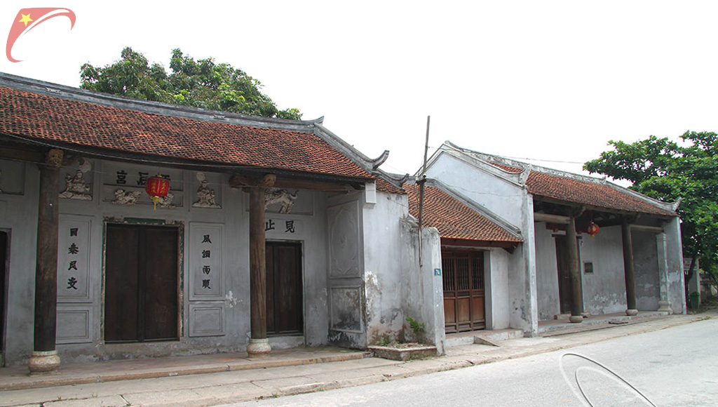
Pho Hien relic complex is located on Pho Hien old territory, now belonging to the land from Dang Chau village (Lam Son ward) to Nam Chau village (Hong Chau ward) on an area of about 5 km x 1 km in Hung Yen town.
Pho Hien used to be an econonic hub of Vietnam, legend has a saying Capital the first, Pho Hien the second. However the golden days of Pho Hien has gone for a long time.
Pho Hien used to be located close to the left bank of the Red River, Pho Hien is 55 km from Hanoi along the river. Previously, from Thang Long down to Pho Hien, it took about 2 days, upstream to the capital took 3 days. Pho Hien's position plays a particularly important role in the waterway routes of the Red - Thai Binh river system in the Northern Delta region.
Pho Hien's most prosperous period was around the middle of the 17th century (1630-1680). After that was the recession process, which took almost two centuries to finally become Hung Yen provincial town. The most obvious manifestation of Pho Hien's recession is the decline in foreign trade. On the other hand, at this time, the regional political situation and the economic and trade system of the East Sea have also changed. China lifted the ban, opening an attractive crowded market. Japan also turned to an export strategy of silver, gold and silk. Direct sea routes become more open without intermediaries, as in the case of Dang Ngoai (northern Vietnam). In such circumstances, foreign trade in Vietnam and Pho Hien in particular have been significantly reduced. Western traders in Pho Hien and Ke Cho closed one after the other, Western merchant ships had very little left in Tonkin. Pho Hien is completely absent from foreign buyers, except for Chinese.
Pho Hien relic complex is located on Pho Hien old territory, now belonging to the land from Dang Chau village (Lam Son ward) to Nam Chau village (Hong Chau ward) on an area of about 5 km x 1 km in Hung Yen town.